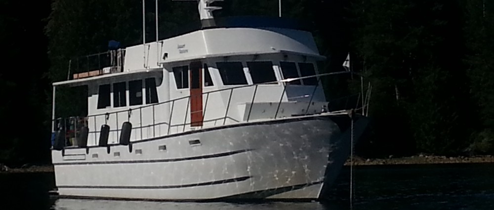
M/V DESERT VENTURE
Places We Go – Columbia River
September 28, 2008
We decided to make Portland, OR and the Columbia River our base for the winter. In truth, there are untold places we could go, and so it comes down to many druthers and comparing ammenities and opportunities. So, for this winter season, Portland won.
Not wanting any moss growing on the hull, and more importantly, not wanting to loose the great weather window, we were underway at first light for Neah Bay. It was a simple voyage, quick riding with the current. Our decision to go south required several days of early departures, in order to go with the current. I admit, those were the first sunrises I have seen in a while – but they were worth it. I will also admit I don’t have that many pistons pinging that early and we only commented on them, not getting pictures. In addition to the sunrises we had beautiful sunsets, and we were blessed with a full moon this entire trip, with some some beautiful moon rises, too. This one is over the Coast Guard station at Neah Bay.


As you can see from the pictures the seas were just not worth talking about. Hole in the wall was flat on both sides, but interestingly flatter on the ocean side.
Just to the west of Cape Flattery and south of Hole in the Wall is the Umatilla Reef. This give you another look at the ocean for the day.
It was a long day to Gray’s Harbor, Westport, WA, at just over 13 hours. Nothing compared to most of our coastal ocean voyages. I was busy nursing the beginnings of the flu and so it was just a day to pass and get further south. The skies were overcast, but there was little wind and the currents were with us, so it was an easy ride. We arrived in Gray’s Harbor, late in the day, when the currents were on the ebb. Of course I have told you, on more than one occasion, you should enter the harbor on the flood…but we couldn’t get there for the flood. So, though there were six foot seas, and the ebb at mid-stroke it was no big deal. The reason why it was no big deal is very important to put in your book of things to remember. There was no wind or big ocean waves, so there were no waves breaking at the river bar. Very important – no wind, no breaking waves. But, look closely in the background of the picture. Fog followed hot on our stern as we entered the bay, with us barely getting tied up before we were engulfed in fog. It was really was an easy ride over the bar. Either that or I am getting WAY too accomplished as a sailor! ;-> Well – maybe a little of both!

We spent two nights in Westport, at Gray’s Harbor. Though the weather wasn’t “that bad”, we knew it was going to improve, and I got an additional day at the dock to nurse my bug, which was a good thing.
I have mixed emotions about the kind of skies we cruise under. I like nice bright and sunny days, but I feel that they are “wasted” if we spend them transiting from one place to another. I feel that nice, sunny, and warm days should be spent at anchor soaking in the healthy rays and lazing about. But then, we get out on the ocean on an overcast grey day with seas to match and it seems a bit uninspiring. So, we take what we get each day and make it count as a good day indeed. That all being said, to lead up to the day we departed Gray’s Harbor (on the ebb, again – no problem) and our overcast arrival at the Columbia River Bar – this time on the flood and the only way to arrive at the Columbia River Bar. This was our second crossing of the Columbia River Bar.
The Columbia River Bar is noted for being the most dangerous river bar in the world by Lloyd’s of London. That being said, it emphasizes the importance of timing and conditions when crossing this bar. This trip was perfect in its crossing. We were with the flood, there were very light winds, no waves, and our over the ground speed averaged between 10.5 and 12.5 knots! And, it was flat! No whirl pools, no eddies, just flat current, carrying us along on a smooth ride! Nice! This is Columbia River Buoy 12. Note the current moving around the buoy, but how flat the seas are surrounding it.

This is Cape Disappointment Lighthouse on the Washington side of the river.
Lewis and Clark believed they had reached the Pacific Ocean, on the Washington side of the river, when in actuality they had reached the mouth of the Columbia River. I assume it was an overcast, probably rainy day, where the visibility was limited and didn’t realize they had not quite reached the Pacific Ocean. The bridge from Astoria, OR across the Columbia River is over three miles long, but the river is wider at other points. They didn’t have the “big bridge” to help them get their bearings. It is no wonder that they thought they were seeing the ocean.


The sea state was flat. I was able to walk around, taking pictures, right and left – no hanging on required! Many of you have heard the story of our first crossing of the Columbia River Bar, as we headed out and south, on my first coastal ocean voyage – destination San Diego, CA. It was a much different experience. I will post it as a separate chapter. I just read it over for the first time in a long time. This was probably my very first blog, and my first real experience in animated conditions. To be honest, it has probably been the most animated time in all our sea miles, and I think it was a head’s up to Captain to moderate our sea state exposure. Being a brilliant man, he saw the long-term benefits on “downsizing” our limits so that his First Mate would want to go – a lot. J
We spent a week in Astoria, letting a weather system pass while we enjoyed 50 amps at a new dock. We rented a car and did all the basics,  including some exploring on the area. The area surrounding Astoria is chock-full of historical sites. From the arrival of Lewis & Clark, to the first trappers and settlers of the area, it is a great place to visit.

Our thoughts go to Lewis & Clark and their arrival and stay in the Pacific NW. They arrived in the fall, it was already into the rainy season. They were wet, cold, and needed a good food source and shelter. They didn’t have the luxury of rain slickers, insulated undies, much less fleece jackets, etc. After finding the ocean, they turned to the need for winter lodgings and crossed from the Washington side of the Columbia River to the Oregon side, making Fort Clatsop their winter headquarters. Fort Clatsop is just south of Astoria on Highway 101, after crossing the Young’s Bay Bridge. When we cross the Young’s Bay Bridge, I often envision Mr. Young, or even Sirs Lewis or Clark, and most likely one of the crew paddling among the small islets fishing or hunting. Can’t you just see them off in the distance?

And so this concludes our summer cruising and the cruise to the Columbia River. It was a simple matter for us. In the beginning, before a voyage, we had long lists for provisioning, spare parts, maintenance jobs, etc. But now, there is no long list of must do’s, check offs, and etc, because we constantly live “the list”. Our only real concern is the weather, which is always in charge of our voyage plans. We have simply become veteran cruisers who are always ready – for the Places We Go…
